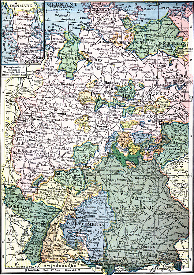
Description: A map showing the western section of Germany and its subdivisions in 1909. The map is color–coded to show the individual states west of Berlin, and shows cities, railroads, and rivers of the country. The map shows the Alsace and Lorraine territories taken from France in 1871, and includes an inset map of Schleswig–Holstein.
Place Names: Germany, Berlin, �Bremen, �Cologne, �Hamburg, �Hannover, �Mannheim, �Nurember
ISO Topic Categories: oceans,
location,
inlandWaters
Keywords: Germany - Western Section, local jurisdictions, �political, �local jurisdictions, oceans,
location,
inlandWaters, Unknown, 1909
Source: C. S. Hammond, Hammond's Handy Atlas of the World (New York, New York: C. S. Hammond & Company, 1911) 78
Map Credit: Courtesy the private collection of Roy Winkelman |
|