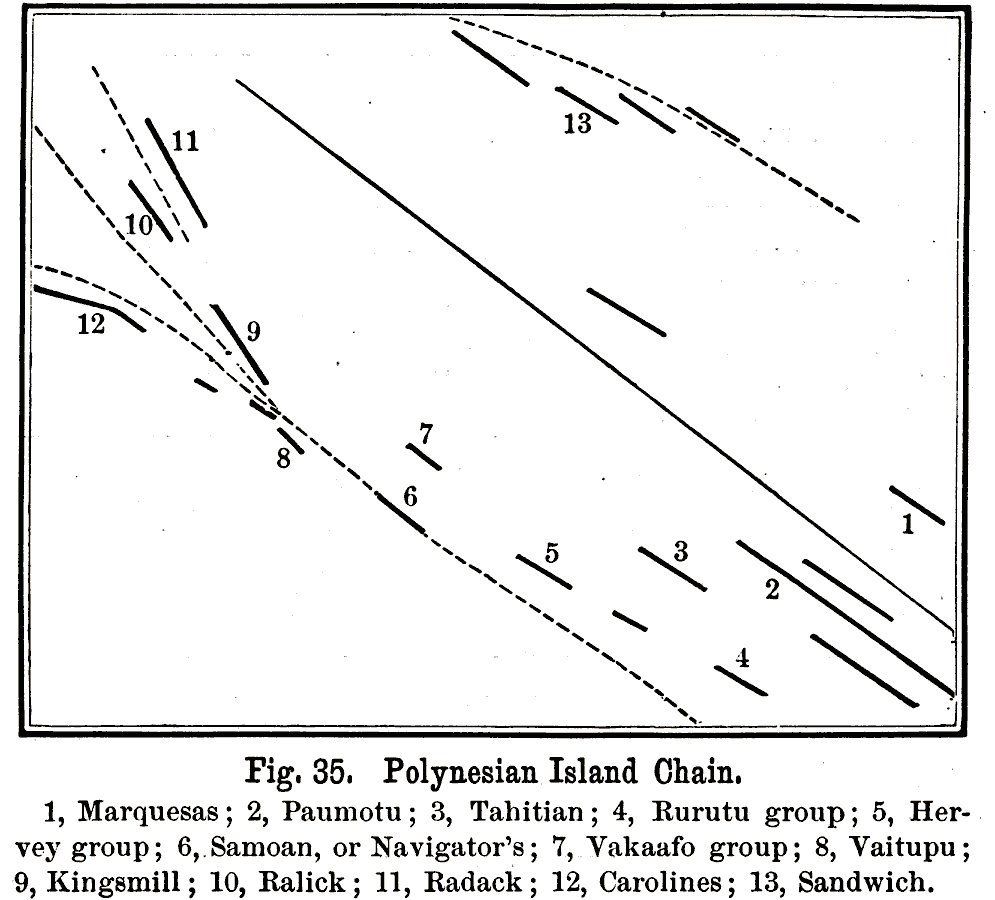
Description: A map of the Polynesian island chains of the Pacific from 1891. The map is keyed to show the Marquesas (1), Paumotu (2), Tahitian (3), Rurutu group (4), Hervey group (5), Samoan or Navigator's (6), Vakaafo group (7), Vaitupu (8), Kingsmill (9), Ralick (10), Radack (11), Carolines (12), and Sandwich or Hawaii (13). "Oceanic islands are those situated far away from the continents. They occur either in vast chains, which generally extend along one or the other of the two lines of trend, or as isolated groups. The Polynesian Chain consists of a series of parallel chains, extending from the Paumotu and the Tahitian Islands to the Carolines, the Ralick, and the Radack groups. Their general direction is north-west; the total length of the chain is about 5500 miles. The Chain of the Sandwich Islands extends in a north-westerly direction. Its length is about 2000 miles." — Houston, 1891, p.40.
Place Names: Regional Pacific Ocean, Caroline, �Marquesas, �New Zealand, �Paumotu, �Samoan, �Tahitian, �Vakaafo,
ISO Topic Categories: land, �water, �physical, kWorldPacific
Keywords: Polynesian Island Chain, land, �water, �physical, physical features, land, �water, �physical, kWorldPacific, Unknown, 1891
Source: Edwin J. Houston, A. M. , The Elements of Physical Geography (Philadelphia, PA: Eldredge & Brother, 1891) 40
Map Credit: Courtesy the private collection of Roy Winkelman |
|