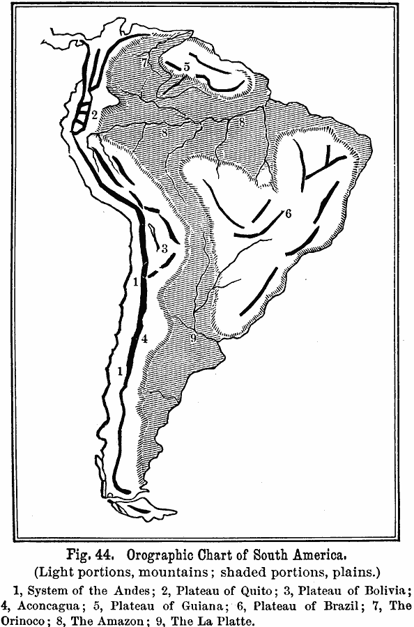
Description: An orographic chart from 1891 showing the various mountain systems, plateaus, plains, and rivers in South America. The map is keyed to show light portions as mountains, and shaded portions as plains, with the system of the Andes (1), Plateau of Quito (2), Plateau of Bolivia (3), Cerro Aconcagua (4), Plateau of Guiana (5), Plateau of Brazil (6), Orinoco River (7), Amazon River (8), and La Plata River (9). "In South America the predominant system is narrow; the secondary systems are broad; the low plain is alluvial, extremely flat, contains no depressions, and consequently no extensive lake–system."e; — Houston, 1891, p. 48.
Place Names: A Complete Map of South America, Argentina, �Bolivia, �Brazil, �Chile, �Columbia, �Ecuador, �Paraguay, �Peru, �Uraguay, �Venezuel
ISO Topic Categories: oceans,
location,
inlandWaters
Keywords: Orographic Chart of South America, land, �mountains, �water, �physical, physical features,
topographical, oceans,
location,
inlandWaters, Unknown, 1891
Source: Edwin J. Houston, A. M. , The Elements of Physical Geography (Philadelphia, PA: Eldredge & Brother, 1891) 47
Map Credit: Courtesy the private collection of Roy Winkelman |
|