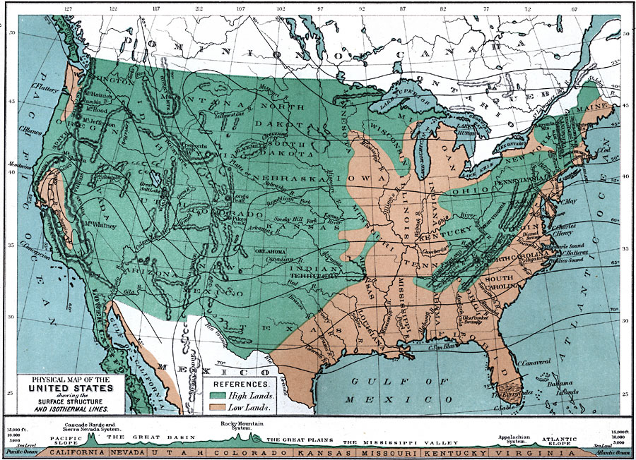
Description: A map from 1891 of the United States showing the physical features of the states, including mountain systems, lakes, rivers, and coastal features. The map is color–coded to show the general areas of highlands and lowlands. Isotherms show mean annual temperature, given in degrees Fahrenheit. A chart at the bottom of the map shows a vertical profile of the United States from the Pacific to the Atlantic, showing the Pacific slope, Cascades and Sierra Nevada mountains, Great Basin, Rocky Mountains, Great Plains, Mississippi Valley, Appalachian system, and Atlantic slope.
Place Names: Meteorology, Boston, �Chicago, �Houston, �Los Angeles, �Miami, �New Orleans, �New York, �San Diego, �Seattle, �Washington D.C., �temperature, �isotherm
ISO Topic Categories: oceans,
location,
inlandWaters
Keywords: The United States Showing the Surface Structure and Isothermal Lines, meteorological, �winds, winds, oceans,
location,
inlandWaters, Unknown, 1891
Source: Edwin J. Houston, A. M. , The Elements of Physical Geography (Philadelphia, PA: Eldredge & Brother, 1891) 141
Map Credit: Courtesy the private collection of Roy Winkelman |
|