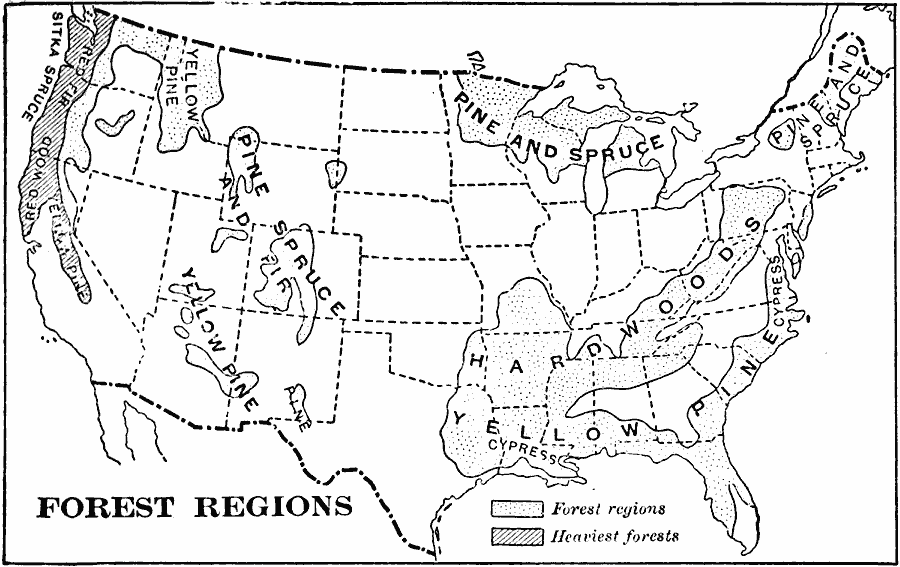
Description: A map from 1897 of the United States showing the forested regions. This map distinguishes areas of heaviest forests, and indicates hardwoods, pine, spruce, cypress, yellow pine, fir, redwood, Sitka spruce, and red fir.
Place Names: Forestry, Boston, �Chicago, �Houston, �Los Angeles, �Miami, �New Orleans, �New York, �San Diego, �Seattle, �Washington D.C
ISO Topic Categories: location,
oceans,
inlandWaters
Keywords: The United States - Forest Regions, statistical, �vegetation, vegetation, location,
oceans,
inlandWaters, Unknown, 1897
Source: Jacques W. Redway & Russell Hinman, Natural Introductory Geography (New York, NY: American Book Company, 1897) 39
Map Credit: Courtesy the private collection of Roy Winkelman |
|