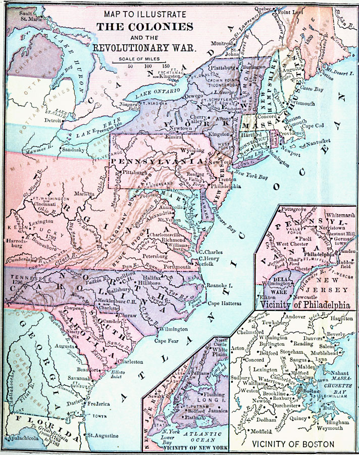
Description: A map of the Thirteen Colonies during the American Revolution. The map shows the territorial claims west of the Allegheny Mountains, and includes inset maps detailing the vicinity of Philadelphia, the vicinity of Boston, and the vicinity of New York. The map also shows the general areas of the Native Americans.
Place Names: Early America 1400-1800, Boston, �Connecticut, �Delaware, �Florida, �Georgia, �Maine, �Maryland, �Massachusetts, �New Hampshire, �New York, �North Carolina, �Pennsylvania, �Philadelphia, �Rhode Island, �South Carolina, �Virginia, �Colonial America, �American Revolutio
ISO Topic Categories: oceans,
location,
inlandWaters
Keywords: The Colonies and the Revolutionary War, American Revolution, �colonies, �historical, kAmericanRevolution, kNativeAmerican, water routes, American Revolution, oceans,
location,
inlandWaters, Unknown,
Source: A. S. Barnes, A Brief History of the United States (New York, NY: American Book Company, 1885)
Map Credit: Courtesy the private collection of Roy Winkelman |
|