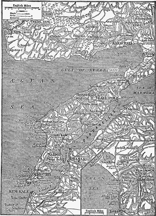
Description: A map from 1919 of the Gallipoli Peninsula in northwestern Turkey. The map illustrates the area of the Gallipoli Campaign or Dardanelles Campaign (25 April 1915 to 9 January 1916) during the First World War. The map shows cities and towns, roads, forts, batteries, and terrain and coastal features of the area, including the Gulf of Xeros (Saros), the &Aelig;gean Sea, Cape Suvla, Cape Helles, the Dardanelles waterway and narrows, the Strait of Gallipoli, and the western mouth of the Sea of Marmora. The landing beaches (A Beach, B Beach, C beach, et cetera) are shown. An inset map details the western tip of the peninsula between Suvla Bay and Gaba Tepe, showing the invasion landing site at Anzac Cove, Z Beach, the objectives of Kojadere, Chunuk Bair, Hill Q, and others.
Place Names: Turkey, Gallipoli, �Maidos, �Krithi
ISO Topic Categories: boundaries,
location,
inlandWaters,
oceans,
transportation
Keywords: Gallipoli Peninsula, physical, �political, �transportation, physical features, local jurisdictions, roads, boundaries,
location,
inlandWaters,
oceans,
transportation, Unknown, 1919
Source: Charles Morris, Winston's Cumulative Encyclopedia Vol 4 (Philadelphia, PA: The John C. Winston Company, 1919) tab 16
Map Credit: Courtesy the private collection of Roy Winkelman |
|