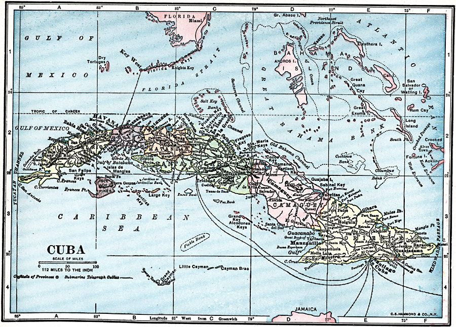
Description: A map from 1919 of Cuba and the Isle of Pines showing the provinces and provincial capitals, major cities and towns, railroads, submarine telegraph cable routes, rivers, terrain and coastal features, reefs, and smaller islands. The map shows the proximity to southern Florida, the Bahamas, and Jamaica.
Place Names: Cuba, Havana, �Guantanamo, �Las Tunas, �Mariel, �Matanzas, �Santa Clara, �Santiago De Cub
ISO Topic Categories: utilitiesCommunication,
boundaries,
location,
oceans,
inlandWaters
Keywords: Cuba, physical, �transportation, �political, physical features, major political subdivisions, railroads, utilitiesCommunication,
boundaries,
location,
oceans,
inlandWaters, Unknown, 1919
Source: Charles Morris, Winston's Cumulative Encyclopedia Vol 3 (Philadelphia, PA: The John C. Winston Company, 1919) tab 7
Map Credit: Courtesy the private collection of Roy Winkelman |
|