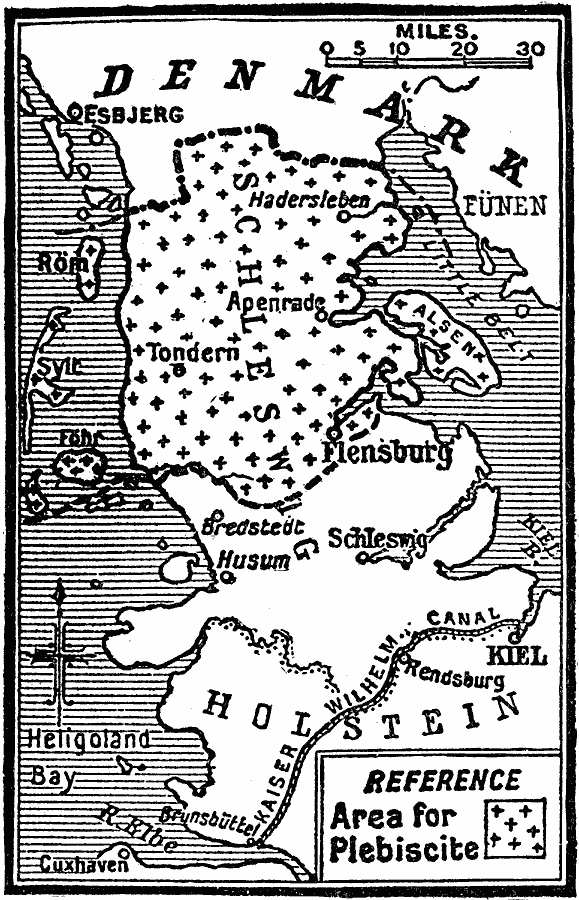
Description: A map showing the re–making of the frontier of Denmark after the Treaty of Versailles in 1919. This map shows the Northern Schleswig area between Denmark and Germany, which was the first plebiscite held (February 14, 1920) to determine the border between the two countries.
Place Names: Denmark, Schleswig, �Flensburg, �Husum, �Tonder
ISO Topic Categories: boundaries,
oceans,
location,
inlandWaters,
transportation
Keywords: Remaking the Frontier of Denmark, physical, �transportation, �political, kVersailles, physical features, country borders, water routes, boundaries,
oceans,
location,
inlandWaters,
transportation, Unknown, 1919
Source: Charles Morris, Winston's Cumulative Encyclopedia Vol 3 (Philadelphia, PA: The John C. Winston Company, 1919) s.v.denmark
Map Credit: Courtesy the private collection of Roy Winkelman |
|