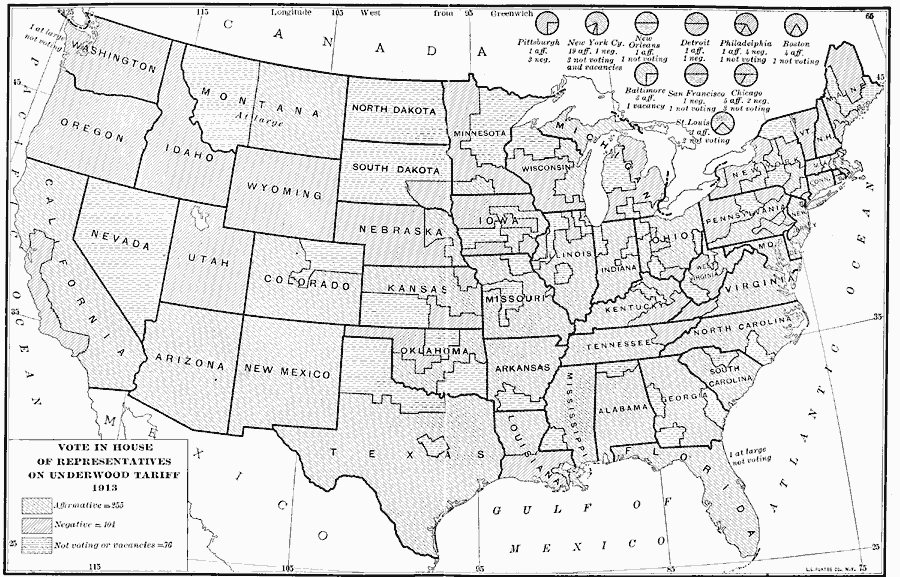
Description: A map of the United States showing the results of the House vote on the Underwood Tariff Bill, also known as the Revenue Act of 1913. The proposed tariff was to reduce the tariffs imposed by the Payne–Aldrich Tariff Act of 1909, and re–impose the federal income tax. The map shows the voting results, with the voting break–outs for the cities of Pittsburgh, New Orleans, Detroit, Boston, Philadelphia, New York City, Baltimore, San Francisco, St. Luis, and Chicago are shown.
Place Names: Elections, House Vot
ISO Topic Categories: boundaries,
location,
oceans
Keywords: Vote on the Underwood Tariff, physical, �political, physical features, country borders,
major political subdivisions, boundaries,
location,
oceans, Unknown, 1913
Source: Albert Bushnell Hart, LL.D., The American Nation Vol. 27 (New York, NY: Harper and Brothers, 1919) 218
Map Credit: Courtesy the private collection of Roy Winkelman |
|