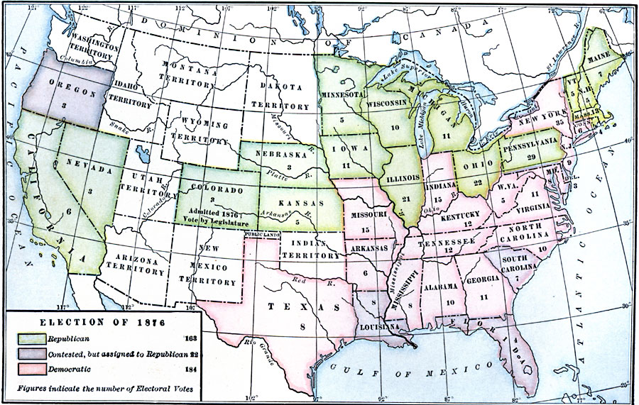
Description: A map of the United States showing the results of the 1876 presidential campaign, one of the most disputed and intense elections in American history. The map is color–coded to show the states carried by the Republicans (Rutherford Hays), Democrats (Samuel Tilden), and the contested states whose votes were assigned to the Republicans. The figures indicate the number of Electoral Votes for each State.
Place Names: Elections, Presidential Electio
ISO Topic Categories: boundaries,
oceans,
location,
inlandWaters
Keywords: Election, physical, �political, physical features, country borders,
major political subdivisions, boundaries,
oceans,
location,
inlandWaters, Unknown, 1876
Source: Albert Bushnell Hart, LL.D., The American Nation Vol. 22 (New York, NY: Harper and Brothers, 1907) 310
Map Credit: Courtesy the private collection of Roy Winkelman |
|