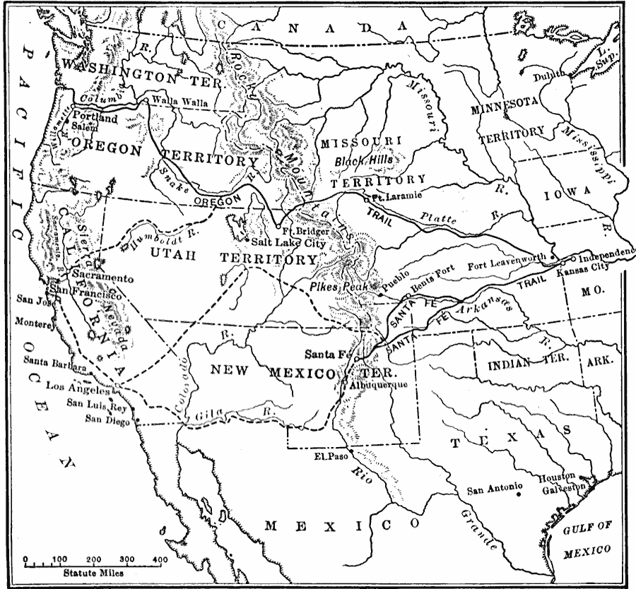
Description: A map of the western United States in 1840–1850 showing the Oregon Trail and Santa Fe, the two principal overland routes from Independence, Missouri, to the western territories and the Pacific. The map shows the territory boundaries, outposts and forts, the mountain barriers, and the alternative routes to southern California and the California goldfields.
Place Names: Growth of Nation, California, �Missouri territory, �New Mexico territory, �Oregon territory, �Rocky Mountains, �Utah territory, �Washington territory, �Oregon Country, �New Mexico, �Oregon Trail, �Sante Fe Trai
ISO Topic Categories: oceans,
location,
inlandWaters,
boundaries
Keywords: The Santa Fe and Oregon trails to the Pacific Coast, borders, �historical, �physical, �roads, �transportation, physical features, roads, historical event, oceans,
location,
inlandWaters,
boundaries, Unknown, 1840–1850
Source: S.E. Forman, Advanced American History (New York, NY: The Century Company, 1919) 366
Map Credit: Courtesy the private collection of Roy Winkelman |
|