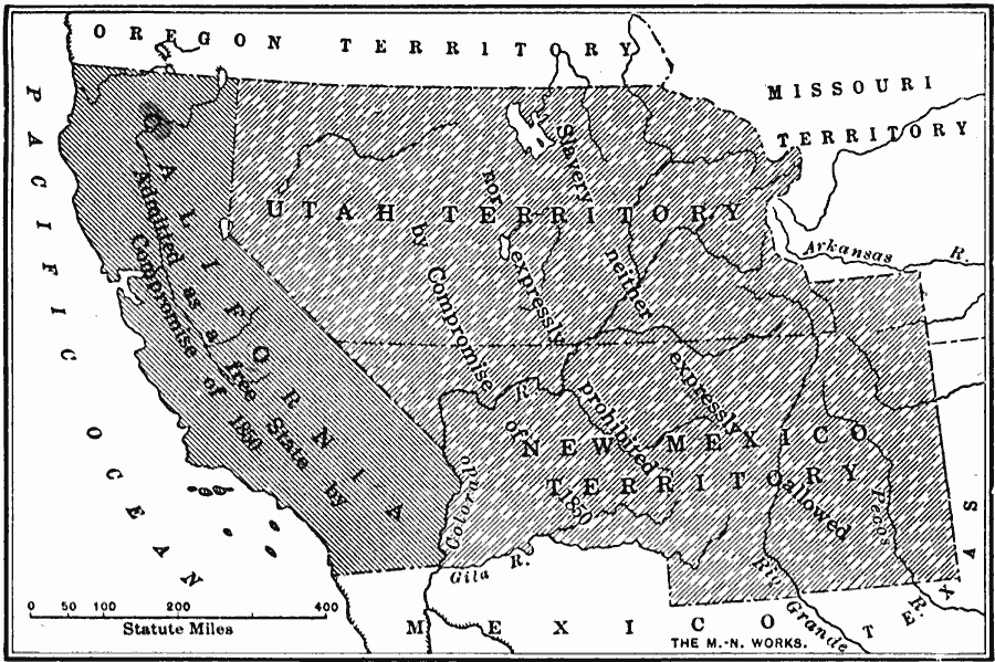
Description: A map of California, the Utah Territory, and the New Mexico Territory in 1850 showing the effect of the Compromise of 1850, a series of bills intending to settle the issue of slavery and abolition raised in the territories after the Mexican–American War (1846–1848). The map shows California as admitted to the Union as a Free State by the Compromise of 1850, and the territories of Utah and New Mexico where slavery was neither expressly allowed nor expressly prohibited by the compromise.
Place Names: Growth of Nation, California, �New Mexico territory, �United States, �Utah territory, �Missouri Territory, �Mexico, �Texas, �Pacific Ocean, �Compromise of 185
ISO Topic Categories: oceans,
location,
inlandWaters,
boundaries
Keywords: The Slavery Prohibition Compromise of 1850, borders, �historical, �physical, ��physical features, historical event, oceans,
location,
inlandWaters,
boundaries, Unknown, 1850
Source: S.E. Forman, Advanced American History (New York, NY: The Century Company, 1919) 386
Map Credit: Courtesy the private collection of Roy Winkelman |
|