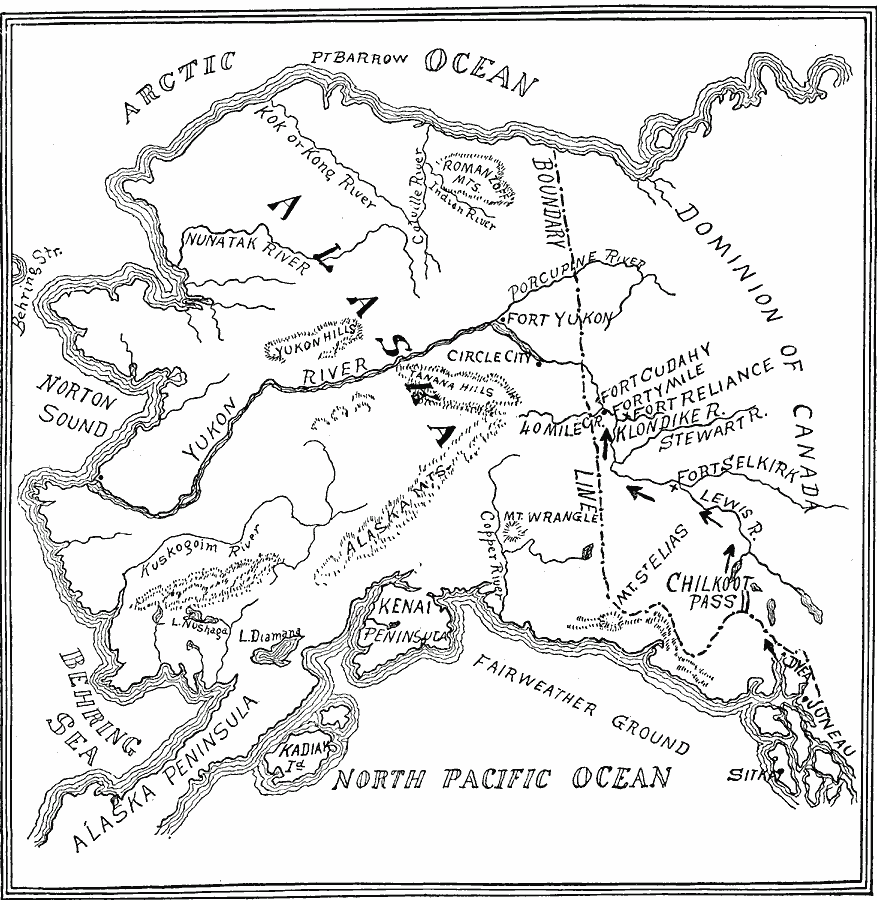
Description: A sketch map of Alaska and northwestern Canada showing the Klondike gold diggings and vicinity. The map shows the routes of the miners during the Klondike gold rush from Dyea near Juneau over the Chilkoot Pass, and the route from Norton Sound up the Yukon River to Fort Yukon. The map shows rivers, mountain systems, and the forts and outposts of the area, including Circle City, Fort Yukon, Fort Cudhay, Forty Mile, Fort Reliance, and Fort Selkirk.
Place Names: Alaska, Anchorage, �Cordova, �Fairbanks, �Juneau, �Kenai, �Kodiak, �Nome, �Palmer, �Sitka, �Skagwa
ISO Topic Categories: oceans,
location,
inlandWaters,
boundaries
Keywords: The Klondike Gold Diggings and vicinity, borders, �historical, �physical, �physical features, ethnological, water routes, historical event, oceans,
location,
inlandWaters,
boundaries, Unknown, 1865–1898
Source: Edward S. Ellis, A. M., Ellis' History of the United States From the Discovery of America to the Present Time (Minneapolis, MN: Western Book Syndicate, 1899) 1803
Map Credit: Courtesy the private collection of Roy Winkelman |
|