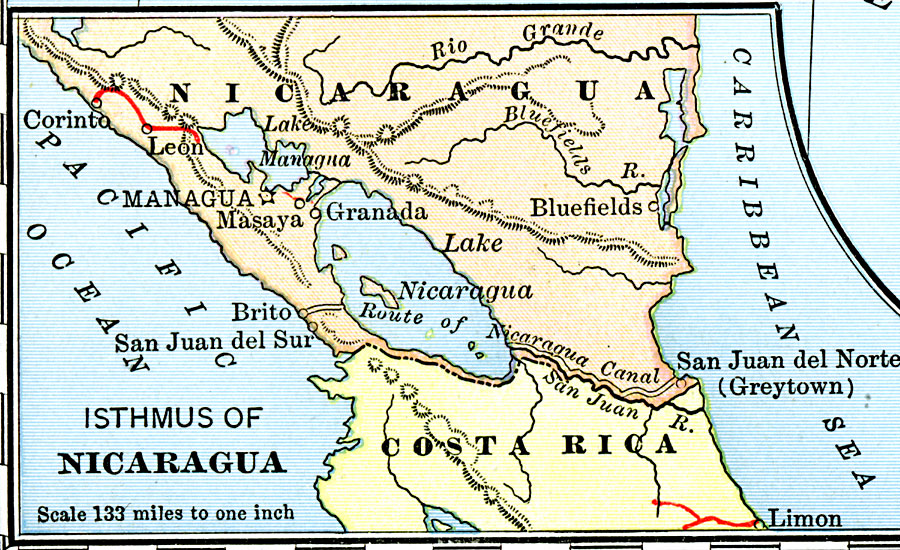
Description: A map from 1901 of the Isthmus of Nicaragua, showing the proposed route of the Atlantic–Pacific canal from San Juan del Norte (Greytown) on the Caribbean coast to Lake Nicaragua, then to Brito near San Juan del Sur on the Pacific coast. Plans for the Nicaragua Canal were abandoned in 1902 when the U.S. Congress approved funds to purchase the French interests in the Panama Canal.
Place Names: Nicaragua, Bluefields, �Granada, �Brito del Sur, �Masaya, �Corinth, �Leo
ISO Topic Categories: boundaries,
inlandWaters,
location,
oceans,
transportation
Keywords: Isthmus of Nicaragua, physical, �political, �transportation, physical features, country borders, railroads, boundaries,
inlandWaters,
location,
oceans,
transportation, Unknown, 1901
Source: Jacques W. Redway, Natural Advanced Geography (New York, NY: American Book Company, 1901) 96
Map Credit: Courtesy the private collection of Roy Winkelman |
|