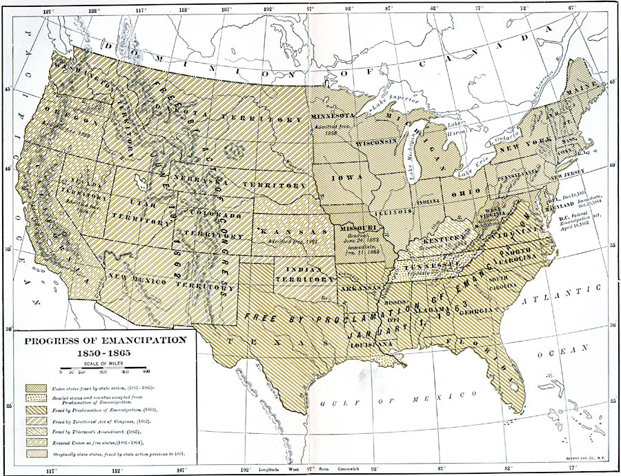
Description: A map of the United States showing the progress of emancipation between 1850 and 1865. The map shows the states and territories during this period, and notes the stage of emancipation and dates of change, and is coded to show areas of Union States freed by state action (1861–1865), seceded states and counties excepted from the Proclamation of Emancipation, areas freed by the Proclamation of Emancipation (1863), areas freed by the Territorial Act of Congress (1862), areas freed by the Thirteenth Amendment (1865), states that entered the Union as free states (1802–1864), and the original slave states, freed by state action previous to 1861.
Place Names: Civil War, emancipation, �Slaver
ISO Topic Categories: boundaries,
oceans,
location,
inlandWaters
Keywords: Progress of Emancipation, physical, �political, physical features, major political subdivisions, boundaries,
oceans,
location,
inlandWaters, Unknown, 1850–1865
Source: Albert Bushnell Hart, LL.D., The American Nation Vol. 20 (New York, NY: Harper and Brothers, 1907) 215
Map Credit: Courtesy the private collection of Roy Winkelman |
|