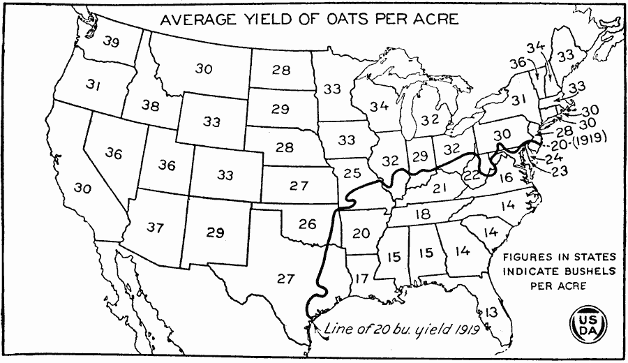
Description: A map of the United States from the U. S. Department of Agriculture (1922) showing the average yield of oats in the United States per state in the years 1869–1919, indicated by bushels per acre. A heavy black line indicates the extent of the 20 bushel yield for the southeastern region in 1919.
Place Names: Agriculture, Oat
ISO Topic Categories: boundaries,
oceans,
farming,
inlandWaters
Keywords: Average Yield of Oats per Acre in the US, physical, �political, �statistical, �average yield of oats per acre in the united states in bushels by state, kAgriculture, physical features, major political subdivisions,
country borders, agriculture, boundaries,
oceans,
farming,
inlandWaters, Unknown, 1869–1919
Source: , United States Department of Agriculture Yearbook 1922 (Washington, DC: Government Printing Office, 1923) 564
Map Credit: Courtesy the private collection of Roy Winkelman |
|