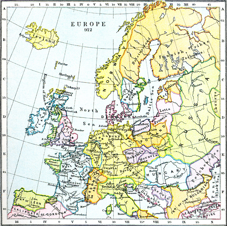
Description: Europe in 912 CE. Map shows the countries, kingdoms, empires, and domains of tribes.
Place Names: A Complete Map of Europe, Iceland, �Danelaw, �Wessex, �Ireland, �Scotland, �Caliphate of Cordova, �Kigndom of Leon, �Gallicia, �Burgundy or Arles, �Kingdom of West Franks, �Brittany, �Kingdom of East Franks, �Italy, �Hungary, �Russia, �Poland, �Servia, �Dalmatia, �Kingdom of t
ISO Topic Categories: boundaries,
inlandWaters,
location,
oceans,
society
Keywords: Europe, physical, �political, �statistical, �europe 912 CE, swedes and goths, finnish tribes, tschudes, petcheneges, physical features, country borders,
major political subdivisions, ethnological, boundaries,
inlandWaters,
location,
oceans,
society, Unknown, AD 912
Source: Samuel Rawson Gardiner D.C.L., L.L.D., School Atlas of English History (London, England: Longmans, Green, and Co., 1914) 8
Map Credit: Courtesy the private collection of Roy Winkelman |
|