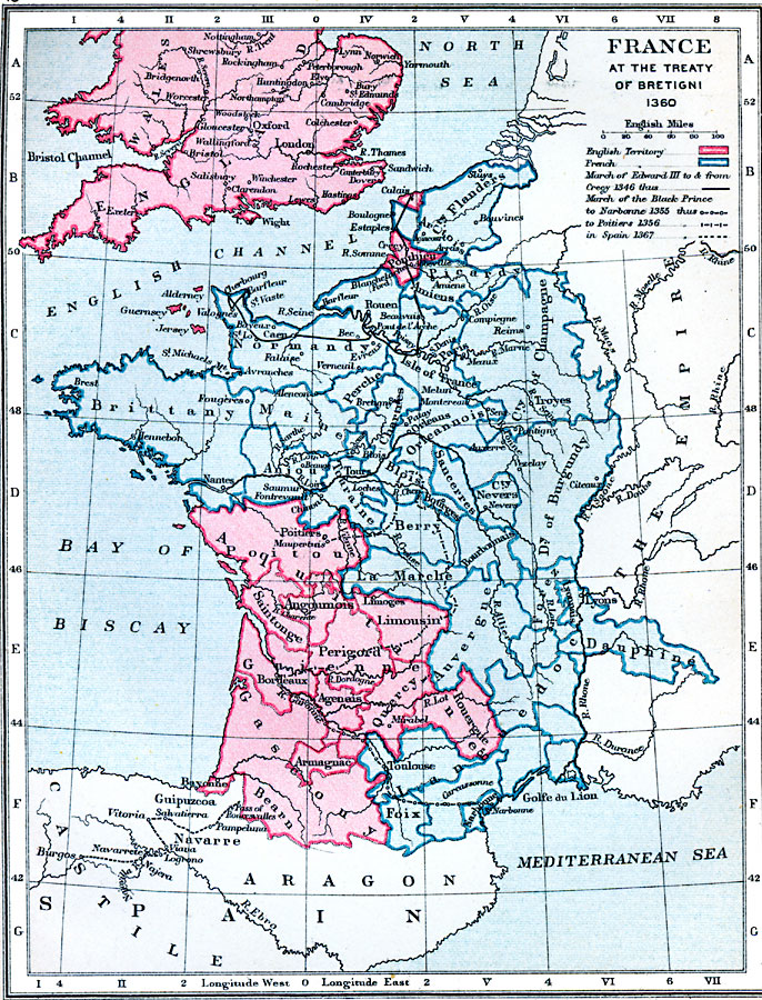
Description: Map of France at the Treaty of Bretigni in 1360. Also shows the March of Edward III and the March of the Black Prince.
Place Names: France, England, �London, �Wales, �Spain, �Aragon, �Brittany, �Normandy, �Maine, �Tours, �La Marche, �Lyons, �Dauphiné, �Dauphine, �Troyes, �Paris, �Orlean
ISO Topic Categories: boundaries,
inlandWaters,
location,
oceans
Keywords: France at the Treaty of Bretigni, physical, �political, �france at the treaty of bretigni 1360, english territory, french territory, march of edward iii to and from cregy 1346, march of the black prince to narbonne, to poiters, to spain, �historical, physical features, country borders,
major political subdivisions, historical event, boundaries,
inlandWaters,
location,
oceans, Unknown, 1360
Source: Samuel Rawson Gardiner D.C.L., L.L.D., School Atlas of English History (London, England: Longmans, Green, and Co.1, 1914) 15
Map Credit: Courtesy the private collection of Roy Winkelman |
|