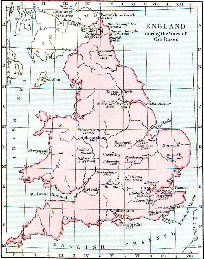
Description: A map of England during the Wars of the Roses (1453–1487), a civil war between the House of Lancaster (Red Rose) and the House of York (White Rose) for the throne of England. The ultimate Lancaster victory led to the Tudor Dynasty. The map shows battlefields with dates given, encampments, places taken, sacked, and ravaged, and treaty sites.
Place Names: United Kingdom, Exeter, �Bristol, �London, �Southampton, �Norwich, �Coventry, �Berwick, �Edinburgh, �Edinboroug
ISO Topic Categories: inlandWaters,
location,
oceans,
boundaries
Keywords: England During the Wars of the Roses, physical, �political, �historical, �england during the war of the roses, physical features, country borders,
major political subdivisions, other military, inlandWaters,
location,
oceans,
boundaries, Unknown, 1455–1485
Source: Samuel Rawson Gardiner D.C.L., L.L.D., School Atlas of English History (London, England: Longmans, Green, and Co.1, 1914) 18
Map Credit: Courtesy the private collection of Roy Winkelman |
|