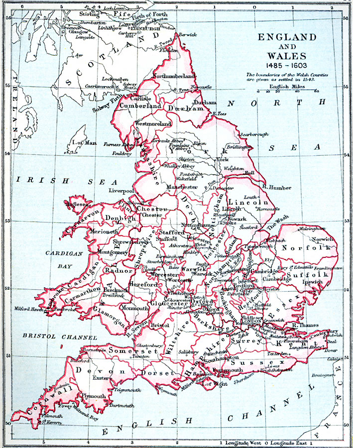
Description: A map of England and Wales during the Tudor Dynasty (1485–1603) founded by Henry VII and ending at the death of Elizabeth I. The boundaries of the Welsh Counties are given as settled by the Laws in Wales Act of 1543 during the reign of King Henry VIII. The map shows county or shire boundaries, major cities and towns, abbey names and significant sites, rivers, and coastal features of the region.
Place Names: United Kingdom, England, �Scotland, �Wales, �Norfolk, �London, �Greenwich, �Kent, �Devon, �Cornwall, �Manchester, �Lincoln, �Durham, �York, �Worcester, �Monmouth, �Bristol, �Gloucester, �Cheste
ISO Topic Categories: inlandWaters,
location,
oceans,
boundaries
Keywords: England and Wales, physical, �political, �england and wales 1485-1603, physical features, country borders,
major political subdivisions, inlandWaters,
location,
oceans,
boundaries, Unknown, 1485 –1603
Source: Samuel Rawson Gardiner D.C.L., L.L.D., School Atlas of English History (London, England: Longmans, Green, and Co.1, 1914) 20
Map Credit: Courtesy the private collection of Roy Winkelman |
|