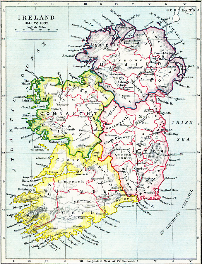
Description: A map of Ireland from the Irish Rebellion of 1641 to prior to the Irish Government Bill (Second Home Rule Bill) passed by the House of Commons in 1893. The map shows the four provinces of Connacht, Leinster, Munster, and Ulster, the counties within the provinces, major cities, towns, and ports, rivers, lakes, mountain systems, and coastal features.
Place Names: Ireland, Cork, �Waterford, �Wexford, �Kildare, �Bantry, �Kilrush, �Limerick, �newy, �Erne, �Belfast, �Dublin, �Tullamor
ISO Topic Categories: inlandWaters,
location,
oceans,
boundaries
Keywords: Ireland, physical, �political, �ireland from 1641 to 1892, munster, connaught, leinster, ulster, donegal, physical features, major political subdivisions, inlandWaters,
location,
oceans,
boundaries, Unknown, 1641–1892
Source: Samuel Rawson Gardiner D.C.L., L.L.D., School Atlas of English History (London, England: Longmans, Green, and Co.1, 1914) 27
Map Credit: Courtesy the private collection of Roy Winkelman |
|