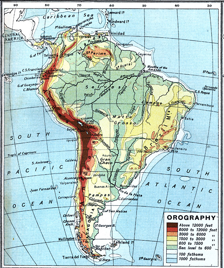
Description: A map showing elevations above and below sea level throughout South America.
Place Names: A Complete Map of South America, Argentina, �Bolivia, �Brazil, �Chile, �Columbia, �Ecuador, �Paraguay, �Peru, �Uraguay, �Venezuel
ISO Topic Categories: inlandWaters,
oceans,
location,
boundaries,
elevation
Keywords: South America - Orographical, physical, �topographical, �political, �borders, �boundaries, �elevation, physical features,
topographical, country borders, inlandWaters,
oceans,
location,
boundaries,
elevation, Unknown, 1915
Source: J.G. Bartholomew, A School Economic Atlas (London, England: Oxford University Press, 1915) 45
Map Credit: Courtesy the private collection of Roy Winkelman |
|