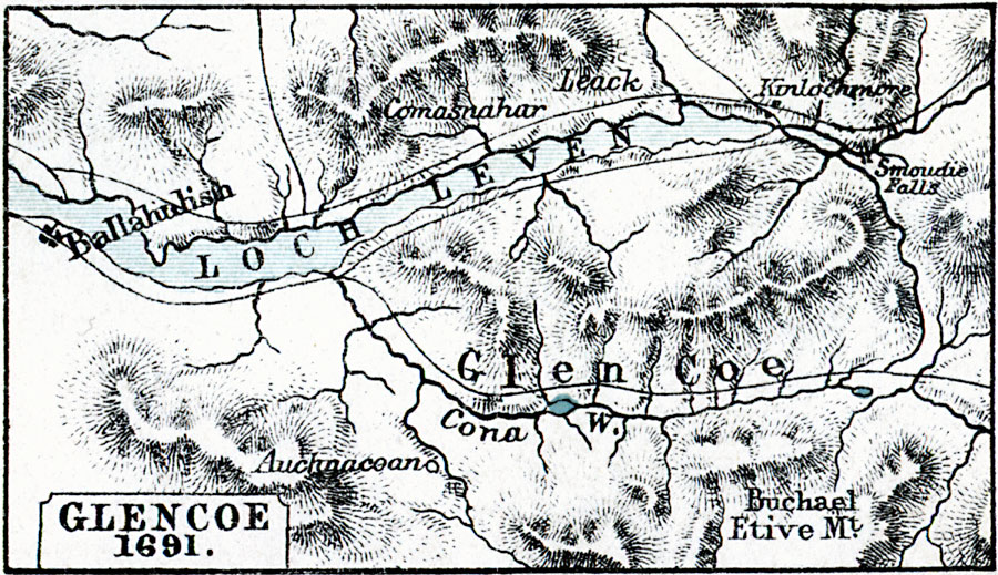
Description: A map of Glencoe, Scotland, site of the infamous massacre on 13 February, 1691, of the Highland Clan MacDonald by companies of the Earl of Argyll's Regiment of Foot by order of King William II of Scotland. The map shows the River Cona, the village of Auchnacoan, Loch Leven, Etive Mountain, roads, and neighboring villages.
Place Names: United Kingdom, Ballahalish, �Comasnahar, �Leack, �Kinlochmore, �Smoudie Falls, �Buchael Etive Mountain, �Loch Leven, �Auchnacea
ISO Topic Categories: inlandWaters,
location
Keywords: Glencoe, physical, �political, �glencoe 1691 scotland, physical features,
topographical, inlandWaters,
location, Unknown, 1691
Source: Samuel Rawson Gardiner D.C.L., L.L.D., School Atlas of English History (London, England: Longmans, Green, and Co., 1914) 37
Map Credit: Courtesy the private collection of Roy Winkelman |
|