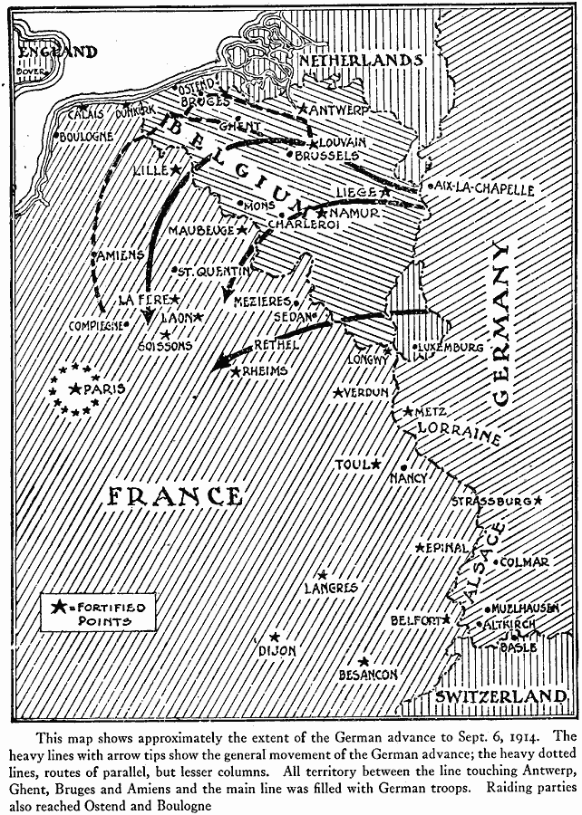
Description: This map shows the German advance across Belgium and Luxemburg toward Paris on September 6, 1914. quot;The heavy lines with arrow tips show the general movement of the German advance; the heavy dotted lines, routes of parallel, but lesser columns. All territory between the line touching Antwerp, Ghent, Bruges and Amiens and the main line was filled with German Troops. Raiding parties also reached Ostend and Boulogne." This map also shows major cities and fortified points on the front between France and Germany, including the fortified circle around Paris.
Place Names: Western Europe, Belgium, �France, �Germany, �Netherlands, �Switzerland, �United Kingdom, Luxemburg
ISO Topic Categories: location,
inlandWaters,
oceans,
boundaries
Keywords: German Advance for Paris, borders, �historical, �physical, �World War I, kWWI, country borders, WWI, location,
inlandWaters,
oceans,
boundaries, Unknown, September 6, 1914
Source: Willis J. Abbot, Pictorial History of the World War (New York, NY: Leslie-Judge Company, 1919) 15
Map Credit: Courtesy the private collection of Roy Winkelman |
|