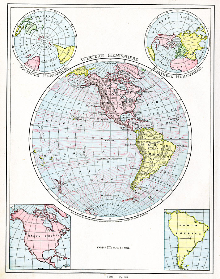
Description: A map from 1901 of the Western Hemisphere, showing the North America and South America land masses with terrain features and major rivers, the Atlantic and Pacific oceans, and the extent of known land in the south polar region at the time. This map includes smaller northern and southern polar perspectives, and outlines of North and South America. The major ocean currents are shown, with direction of flow indicated by arrows. An outline map of Kansas is given to show relative area comparison.
Place Names: Western Hemisphere, Africa, �Antarctica, �Asia, �Australia, �Europe, �North America, �South Americ
ISO Topic Categories: oceans,
location,
inlandWaters
Keywords: Western Hemisphere, country borders, �physical, kComparativeArea, country borders, oceans,
location,
inlandWaters, Unknown, 1901
Source: James A. Bowen, Grammar School Geography (Chicago, IL: Rand, McNally & Company, 1901) 62
Map Credit: Courtesy the private collection of Roy Winkelman |
|