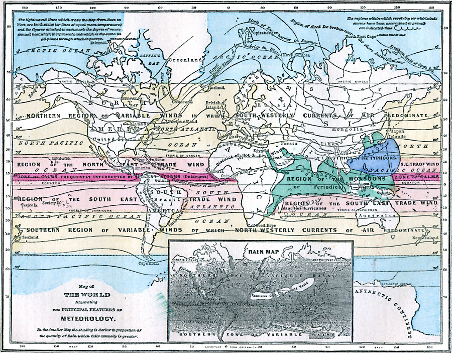
Description: A map from 1868 of the world, showing the principal features of meteorology given in isotherms (or lines of equal mean temperature) and the figures attached to each mark the degree of mean annual heat which it represents. The map shows the probable Equator of Temperature or line of maximum heat, and the limits of northern ice barriers in winter and summer. The map is color–coded to show wind regions, including the Trade Winds, regions of variable winds, doldrums, and includes the regions of revolving storms, including the districts of Atlantic and Mauritius hurricanes, region of monsoons, and the district of typhoons. An inset map shows the distribution of rainfall, with shading proportionally indicating rainfall amounts.
Place Names: A Complete Map of Globes and Multi-continent, Africa, �Antarctica, �Asia, �Australia, �Europe, �North America, �South Americ
ISO Topic Categories: oceans,
inlandWaters,
location,
climatologyMeteorologyAtmosphere
Keywords: Map of the World illustrating the Principal Features of Meteorology, borders, �climate, �meteorological, �rainfall, �temperature, �winds, kClimate, climate,
winds,
rainfall,
temperature, oceans,
inlandWaters,
location,
climatologyMeteorologyAtmosphere, Unknown, 1868
Source: George W. Fitch, Outlines of Physical Geography (New York, NY: Ivison, Phinney, Blakeman & Company, 1868) 54
Map Credit: Courtesy the private collection of Roy Winkelman |
|