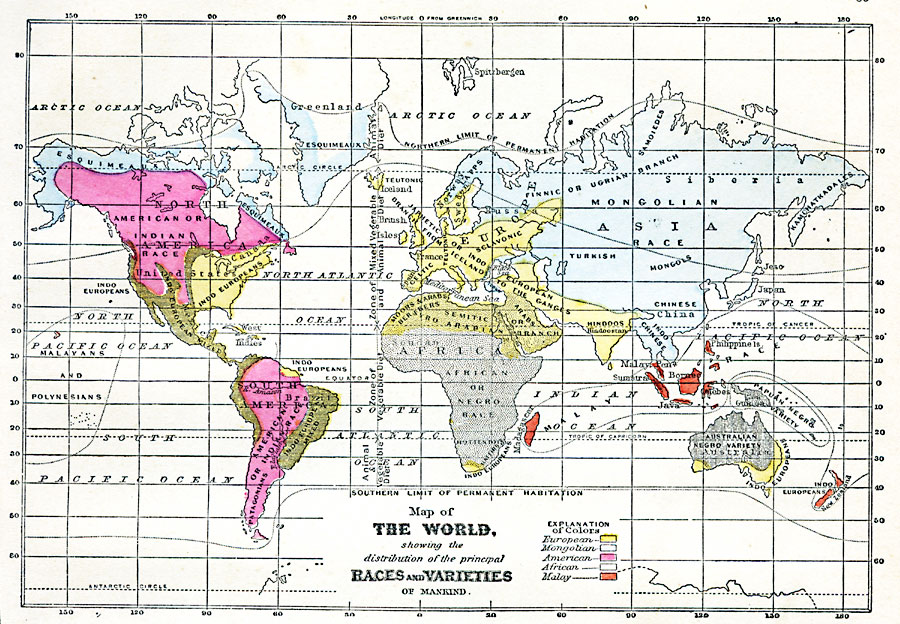
Description: A map from 1868 of the world, showing the distribution of the principal races and varieties of mankind as accepted at the time. The map is color–coded to show the areas where the predominant populations are European, Mongolian, American Native, African, and Malay. The map also distinguishes areas of mixed races and specific groups. The northern and southern limits of permanent habitation are shown, as well as a vertical line indicating the latitudinal ranges of primarily vegetable, animal, and mixed animal–vegetable diets.
Place Names: A Complete Map of Globes and Multi-continent, Africa, �Antarctica, �Asia, �Australia, �Europe, �North America, �South Americ
ISO Topic Categories: oceans,
inlandWaters,
location
Keywords: Map of the World showing the distribution of the Principal Races and Varieties of Mankind, borders, �mankind, �race, �statistical, kEthnic, population, oceans,
inlandWaters,
location, Unknown, 1868
Source: George W. Fitch, Outlines of Physical Geography (New York, NY: Ivison, Phinney, Blakeman & Company, 1868) 85
Map Credit: Courtesy the private collection of Roy Winkelman |
|