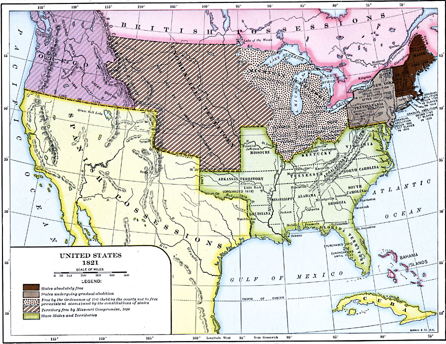
Description: A map of the United States in 1821 showing the states and territories which either accepted or abolished slavery after the Missouri Compromise of 1820. The map is color–coded to show absolutely free states, states undergoing gradual abolition, free by the Ordinance of 1787, territory free by the Missouri Compromise, and slave states and territories.
Place Names: A Complete Map of the United States, Alabama, �Arkansas Territory, �Connecticut, �Delaware, �Florida Territory, �Georgia, �Indiana, �Kentucky, �Maine, �Maryland, �Massachusetts, �Michigan Territory, �Mississippi, �Missouri, �New Jersey, �New York, �North Carolina, �Ohio, �Pennsylvania,
ISO Topic Categories: oceans,
location,
inlandWaters
Keywords: The United States, borders, �political, country borders, oceans,
location,
inlandWaters, Unknown, 1821
Source: Dixon Ryan Fox, Harper's Atlas of American History (New York, NY: Harper & Brothers Publishers , 1920) 37
Map Credit: Courtesy the private collection of Roy Winkelman |
|