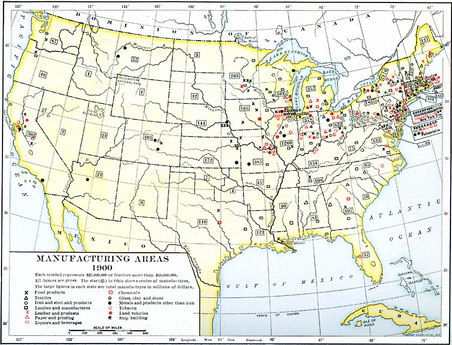
Description: A map from 1920 of the United States showing the principal manufacturing areas in 1900. The star symbol in Ohio represents the mean center of manufacturing in the nation. Each symbol represents gross $25,000,000 or fraction more than $10,000,000. The figures in the boxes represent total manufactures for each State in millions of dollars. The symbols represent manufacture of food products, textiles, iron and steel products, lumber, paper and printing, liquors and beverages, chemicals, glass, clay, and stone, metals and products other than iron, tobacco, land vehicles, and ship building.
Place Names: Industry, Alabama, �Arkansas, �California, �Delaware, �Florida, �Georgia, �Illinois, �Indiana, �Iowa, �Kentucky, �Maine, �Maryland, �Nebraska Territory, �New Jersey, �New Mexico Territory, �New York, �North Carolina, �Pennsylvania, �South Carolina, �Tennessee,
ISO Topic Categories: oceans,
location,
inlandWaters
Keywords: Manufacturing Areas , economic, �manufacturing, �statistical, kIndustry, economic, historical event, oceans,
location,
inlandWaters, Unknown, 1900
Source: Dixon Ryan Fox, Harper's Atlas of American History (New York, NY: Harper & Brothers Publishers , 1920) 76
Map Credit: Courtesy the private collection of Roy Winkelman |
|