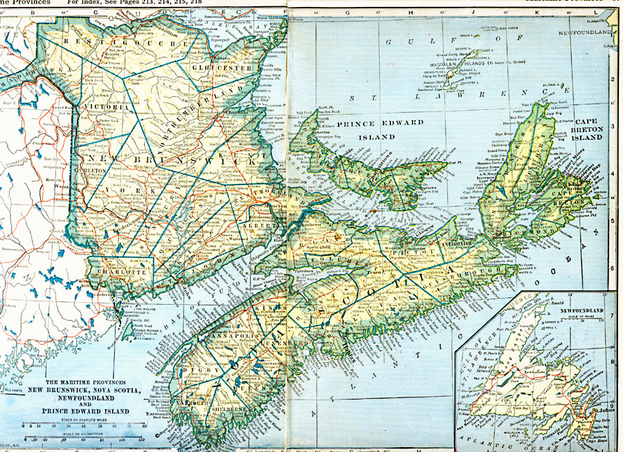
Description: A map from 1921 of the Maritime Provinces of Canada (New Brunswick, Prince Edward Island, and Nova Scotia) showing the electoral districts, major cities, towns and ports, existing and proposed railways, terrain and coastal features, rivers, and lakes of the province. An inset map shows Newfoundland.
Place Names: Canada, Cape Breton Island, �New Brunswick, �Nova Scotia, �Newfoundland, �Prince Edward Islan
ISO Topic Categories: oceans,
location,
inlandWaters,
transportation
Keywords: The Maritime Provinces, borders, �physical, �railroads, �transportation, �country borders,
county borders, railroads, oceans,
location,
inlandWaters,
transportation, Unknown, 1921
Source: L.L. Poates, Poates Complete Atlas of the World (New York, NY: Poates Corporation , 1921) 16-17
Map Credit: Courtesy the private collection of Roy Winkelman |
|