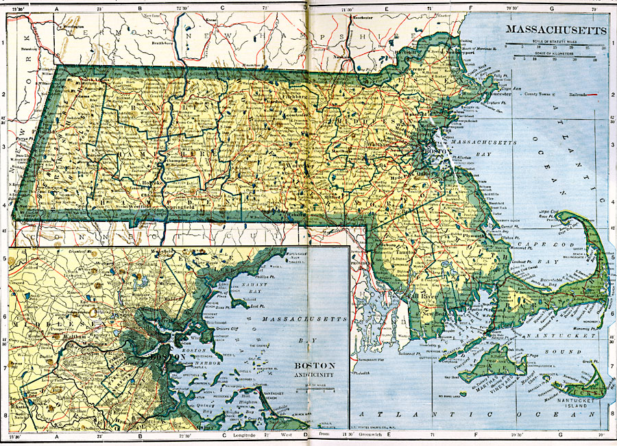
Description: A map from 1919 of Massachusetts showing the capital Boston, major cities, towns, and ports, counties and county seats, railroads, mountains, lakes, rivers, and coastal islands and features. An inset map details the vicinity of Boston.
Place Names: Massachusetts, Boston, �Cambridge, �Cape Cod, �Fall River, �Lowell, �Martha's Vineyard, �Nantucket, �New Bedford, �Salem, �Springfield, �Waltham, �Worcheste
ISO Topic Categories: oceans,
location,
inlandWaters,
transportation
Keywords: Massachusetts, borders, �physical, �railroads, �transportation, �country borders,
county borders, railroads, oceans,
location,
inlandWaters,
transportation, Unknown, 1919
Source: L.L. Poates, Poates Complete Atlas of the World (New York, NY: Poates Corporation , 1921) 66-67
Map Credit: Courtesy the private collection of Roy Winkelman |
|