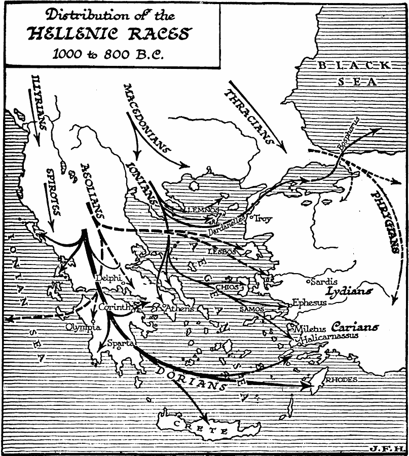
Description: A map of the Hellas region showing the distribution of the Hellenic races, between 1,000 and 800 BC. The map shows the migration of the Illyrians, Macedonians, and Thracians from the northern Balkans, the Epirotes, Aeolians, and Dorians through Greece and southern Aegean Sea to Rhodes and Crete, the Ionians through eastern Greece to Attica and western Aegean to Lesbos and Lydia through the Bosphorus to the Black Sea, the distribution of the Phrygians, and the territories of the Lydians and Carians. The cities of Delphi, Olympia, Corinth, Athens, Sparta, Troy, Sardis, Ephesus, Miletus, and Halicarnassus are shown.
Place Names: Southeastern Europe,
ISO Topic Categories: boundaries,
location,
oceans,
inlandWaters
Keywords: Distribution of Hellenic Races, physical, �transportation, �statistical, kAncientGreece, physical features, ethnological, water routes, boundaries,
location,
oceans,
inlandWaters, Unknown, 1,000–800 BC
Source: H. G. Wells, The Outline of History (New York, NY: The Macmillan Company, 1921) 258
Map Credit: Courtesy the private collection of Roy Winkelman |
|