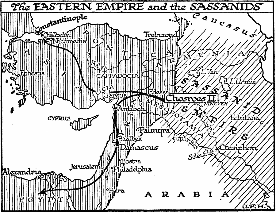
Description: A map of the Eastern Empire and the Sassanid Empire at the time of Chosroes II (AD 590–628). This map shows the Byzantine territories of Pontica, Cappadocia, Cilicia, the western portions of Armenia and Mesopotamia, Syria, and Egypt, and cities of Constantinople, Chalcedon, Nicomedia, Trebizond, Ephesus, Tarsus, Edessa, Antioch, Palmyra, Baalbek, Damascus, Bostra, Jerusalem, Philadelphia, Petra, and Alexandria. The map shows the Sassanid territories of the eastern portions of Armenia and Mesopotamia, and the cities or Nineveh, Ecbatana, Seleucia, and Ctesiphon. The map shows the routes of conquest under Chosroes II. "Three times (in 608, 615, and 627) his armies reached Chalcedon, which is over against Constantinople; he took Antioch, Damascus, and Jerusalem (614) [...] In 619, Chosroes II conquered that facile country, Egypt." — Wells, 1921, p. 539.
Place Names: Regional AfroAsia, Africa, �Asia, �Mesopotamia, �Arabia, �Egyp
ISO Topic Categories: physical, �political, kWorldMedSea, kWorldAfroAsia, kWorldEurasia
Keywords: The Eastern Empire and the Sassanids, physical, �political, physical features, major political subdivisions, physical, �political, kWorldMedSea, kWorldAfroAsia, kWorldEurasia, Unknown, AD 590–628
Source: H. G. Wells, The Outline of History (New York, NY: The Macmillan Company, 1921) 541
Map Credit: Courtesy the private collection of Roy Winkelman |
|