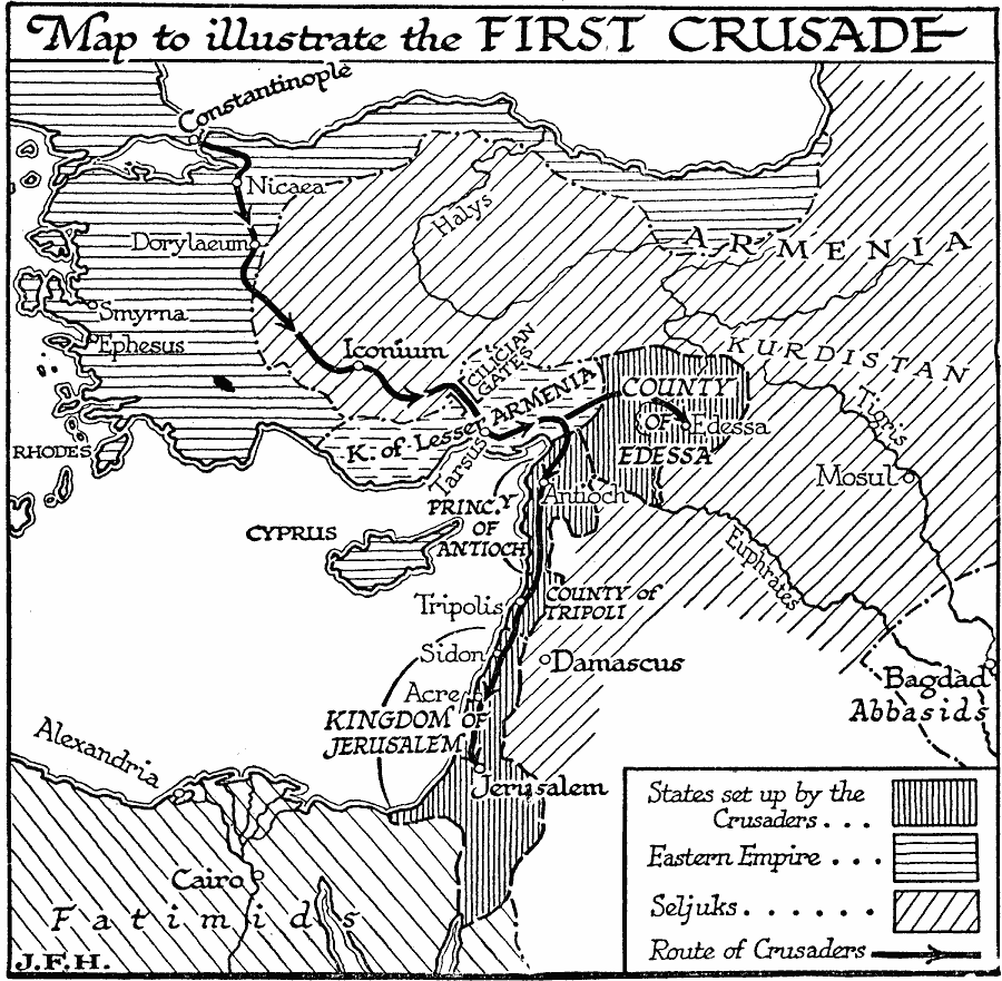
Description: A map of the region of the First Crusade launched by Pope Urban II in 1095. This map shows the territory of the Eastern Empire (Byzantine), the Seljuks, the Fatimids, Abbasids, the states set up by the Crusaders, including the County of Edessa, Principality of Antioch, County of Tripoli, and the Kingdom of Jerusalem, and the route of the Crusaders from Constantinople to Jerusalem. The map shows important cities along the route, including Nicaea, Dorylaeum, Iconium, the mountain pass of the Cilician Gates, Tarsus in the Kingdom of Lesser Armenia, Edessa, Antioch, Tripolis, Sidon, and Acre, as well as other important cities of the time including Smyrna, Ephesus, Mosul, Damascus, Bagdad, Cairo, and Alexandria.
Place Names: Regional Mediterranean, Africa, �Asia, �Europ
ISO Topic Categories: political, �physical, kWorldMedSea, kWorldAfroAsia
Keywords: The First Crusade, political, �physical, physical features, major political subdivisions, political, �physical, kWorldMedSea, kWorldAfroAsia, Unknown, 1095–1099
Source: H. G. Wells, The Outline of History (New York, NY: The Macmillan Company, 1921) 641
Map Credit: Courtesy the private collection of Roy Winkelman |
|