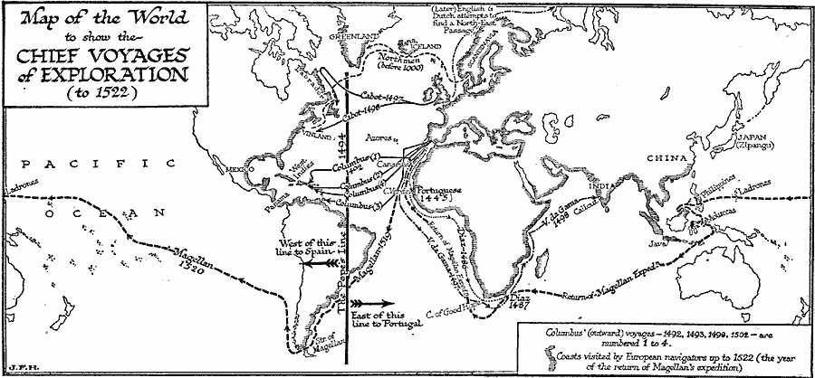
Description: A map of the world, showing the chief European voyages of exploration between the Norsemen (before AD 1000) up to the return of the Magellan expedition in 1522. The map shows coasts visited by European explorers, including the Portuguese voyages along Africa (Cape Verde – 1445), Diaz to the Cape of Good Hope (1487) and Vasco de Gama to Calicut India (1498), the four outward voyages of Columbus (1492–1502), the voyages of Cabot (1497–8), and the voyage of Magellan (1519–1522). The map shows the Pope's Line established by the Treaty of Tordesillas in 1494, which gave all newly discovered lands east of the line to Portugal and west of the line to Spain. The map also shows the later route of the English and Dutch attempts to find a North–East passage from Europe to Asia.
Place Names: A Complete Map of Globes and Multi-continent, Africa, �Asia, �Australia, �Europe, �North America, �South Americ
ISO Topic Categories: transportation,
inlandWaters,
location,
oceans
Keywords: Chief Voyages of Exploration, physical, �transportation, physical features, water routes, transportation,
inlandWaters,
location,
oceans, Unknown, 1492–1522
Source: H. G. Wells, The Outline of History (New York, NY: The Macmillan Company, 1921) 745
Map Credit: Courtesy the private collection of Roy Winkelman |
|