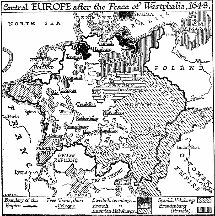
Description: A map of Central Europe after the Peace of Westphalia in 1648 showing the boundary of the Holy Roman Empire, territories of the Swedes, French, Austrian Habsburgs, Spanish Habsburgs, and Brandenburg (Prussian), with free towns underlined.
Place Names: Central Europe, France, �Poland,�Ottoman Empire, �Denmark, �Prussia, �Bohemia, �Saxony, �Holland, �Switzerland, �Swede
ISO Topic Categories: oceans,
location,
inlandWaters,
boundaries
Keywords: Central Europe at the Peace of Westphalia, physical, �political, kThirtyYearsWar, physical features, country borders, oceans,
location,
inlandWaters,
boundaries, Unknown, 1648
Source: H. G. Wells, The Outline of History (New York, NY: The Macmillan Company, 1921) 784
Map Credit: Courtesy the private collection of Roy Winkelman |
|