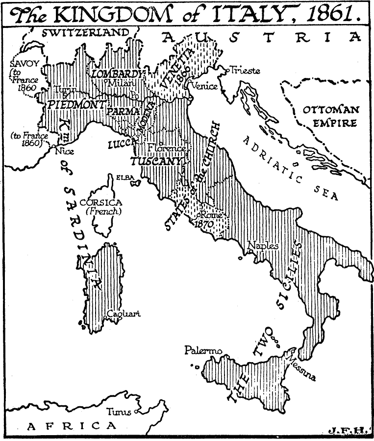
Description: A map of the Kingdom of Italy in 1861, showing the states joined under unification, the two states (Savoy and Nice) ceded to France as part of the unification effort under the Plombiéres Pact, Venetia, which became part of the kingdom in 1866 after the Austro–Prussian War, and the western States of the Church (and Rome) in 1870.
Place Names: Italy, Naples, �Rome, �Florence, �Turin, �Mila
ISO Topic Categories: boundaries,
location,
inlandWaters,
oceans
Keywords: Kingdom of Italy, physical, �political, physical features, major political subdivisions,
country borders, boundaries,
location,
inlandWaters,
oceans, Unknown, 1861
Source: H. G. Wells, The Outline of History (New York, NY: The Macmillan Company, 1921) 967
Map Credit: Courtesy the private collection of Roy Winkelman |
|