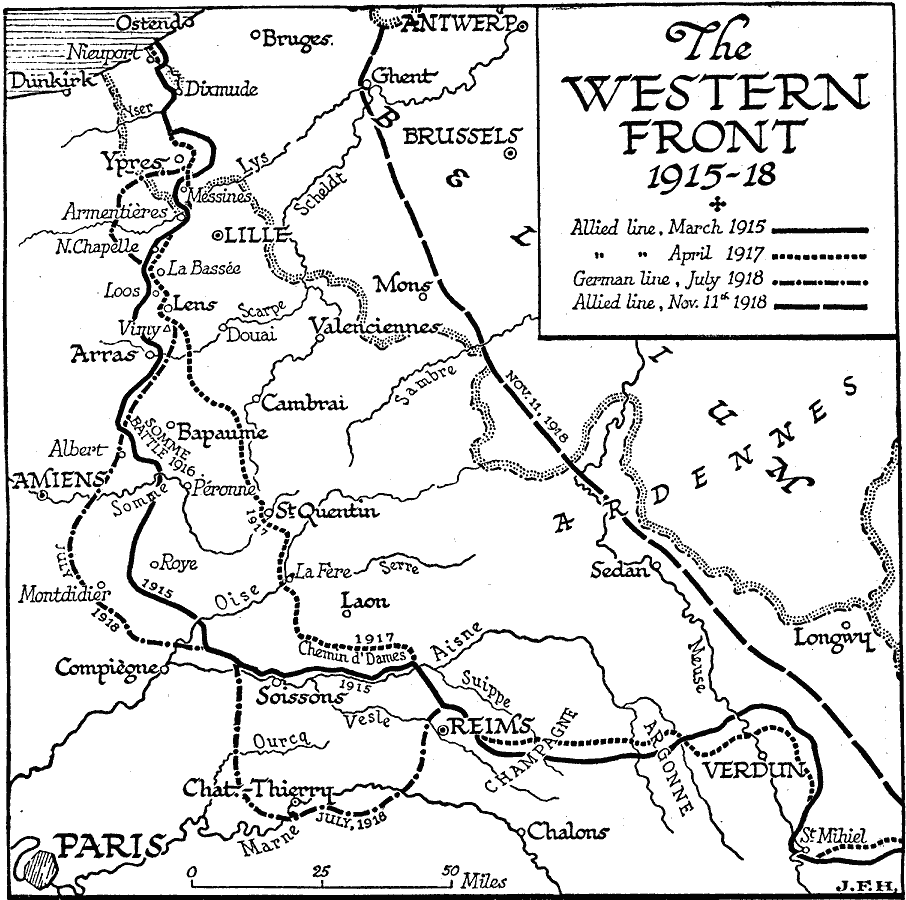
Description: A map showing the lines of the Western Front in World War One, between 1915–1918, including the Allied lines in March, 1915 and April, 1917, the German line at its furthest western extent in July, 1918, and the final Allied line on November 11, 1918. The map shows important cities of the conflict, the site of the Somme Battle in 1916, and major rivers of the region.
Place Names: Western Europe, France, �Belgiu
ISO Topic Categories: location,
oceans,
inlandWaters,
intelligenceMilitary,
boundaries
Keywords: The Western Front, physical, �political, �historical, kWWI, physical features, country borders, WWI, location,
oceans,
inlandWaters,
intelligenceMilitary,
boundaries, Unknown, 1915–1918
Source: H. G. Wells, The Outline of History (New York, NY: The Macmillan Company, 1921) 1039
Map Credit: Courtesy the private collection of Roy Winkelman |
|