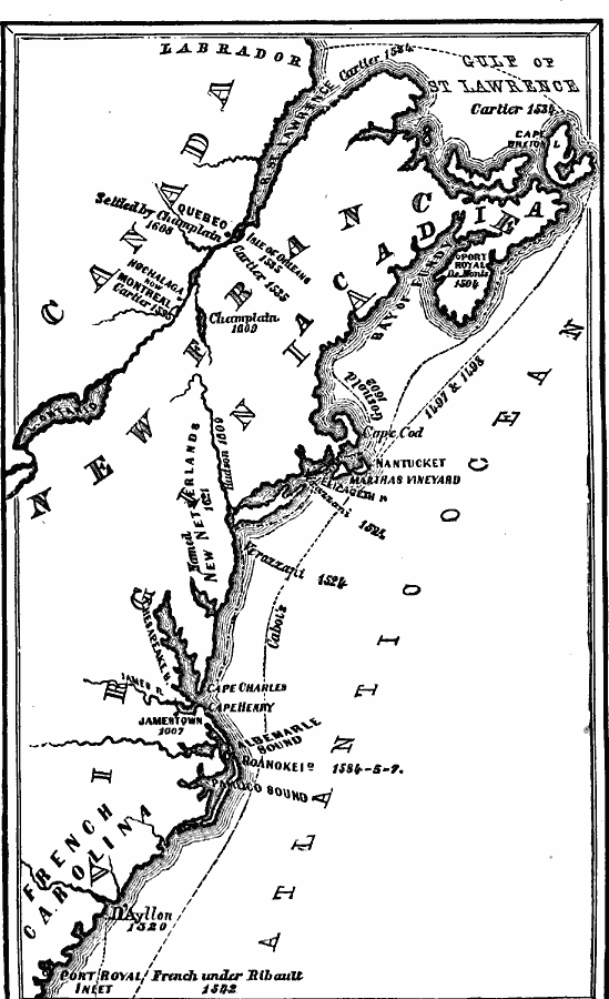
Description: A map of the eastern coast of North America showing early European exploration from the voyages of Cabot (1497 and 1498) to the founding of New Netherlands in 1621. The map shows voyage routes, coastal features, rivers, and settlements with dates given. The map covers the coast from Port Royal Inlet in French Carolina north to the Gulf of St. Lawrence and inland to Quebec, Montreal, and Lake Ontario.
Place Names: A Regional Map of North America, Canada, �United State
ISO Topic Categories: oceans,
location,
inlandWaters,
boundaries
Keywords: Early Discoveries and Explorations, borders, �physical, �historical, country borders, oceans,
location,
inlandWaters,
boundaries, Unknown, 1497–1621
Source: David B. Scott, A School History of the United States, from the discovery of America to the year 1880. (New York, NY: American Book Company, 1884) 14
Map Credit: Courtesy the private collection of Roy Winkelman |
|