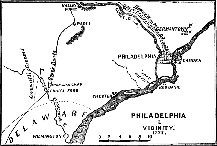
Description: A map of Philadelphia and vicinity in 1777 during the capture of the city by British Major General William Howe. The map shows the route of Howe's Philadelphia Campaign from Elkton to Chad's Ford, site of the Battle of Brandywine against Washington, Paoli, site of the Paoli Massacre, his crossing of the Schuylkill River above Valley Forge, and route to Philadelphia.
Place Names: Early America 1400-1800, Delaware, �Pennsylvania, �Philadelphia, �Wilmington, �American Revolutio
ISO Topic Categories: oceans,
location,
inlandWaters
Keywords: Philadelphia and Vicinity, American Revolution, �physical, �historical, �military, kAmericanRevolution, country borders, historical event,
American Revolution, oceans,
location,
inlandWaters, Unknown, 1777
Source: David B. Scott, A School History of the United States, from the discovery of America to the year 1880. (New York, NY: American Book Company, 1884) 183
Map Credit: Courtesy the private collection of Roy Winkelman |
|