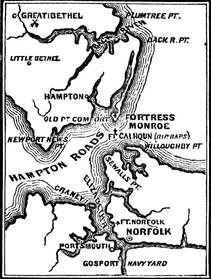
Description: A map of the vicinity of Fort Monroe near Hampton and Norfolk, Virginia, during the American Civil War. The map shows forts, coastline features, the site of the Battle of Great Bethel, and the waters of Hampton Roads off Sewell's Point where the naval battle between the ironclads CSS Virginia and USS Monitor took place. Fort Monroe remained under Union control during the war.
Place Names: Civil War, Hampton, �Newport News, �Norfolk, �Portsmout
ISO Topic Categories: oceans,
location,
inlandWaters
Keywords: Vicinity of Fortress Monroe, physical, �historical, �military, �war, �country borders, historical event, oceans,
location,
inlandWaters, Unknown, 1861–1865
Source: David B. Scott, A School History of the United States, from the discovery of America to the year 1880. (New York, NY: American Book Company, 1884) 324
Map Credit: Courtesy the private collection of Roy Winkelman |
|