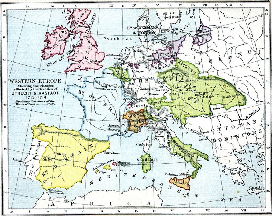
Description: A map of Western Europe in 1713–1714, showing the results of the treaties of Utrecht and Rastadt. The map is color–coded to show the territories of the Kingdom of Great Britain, Kingdom of France, Kingdom of Spain, Prussia, Duchy of Savoy, and the hereditary dominions of the House of Austria.
Place Names: Western and Central Europe, Ireland, �Scotland, �England, �Great Britain, �Denmark, �Norway, �Sweden, �Poland, �Spain, �Portugal, �France, �Switzerland, �Naples, �Prussi
ISO Topic Categories: inlandWaters,
location,
oceans,
boundaries
Keywords: Western Europe, physical, �political, �historical, �war of may 1702, queen anne's war, war of spanish succession, treaties of utrecht and rastadt, hereditary dominions of the house of austria, physical features, country borders,
major political subdivisions, other military, inlandWaters,
location,
oceans,
boundaries, Unknown, 1713–1714
Source: Samuel Rawson Gardiner D.C.L., L.L.D., School Atlas of English History (London, England: Longmans, Green, and Co., 1914) 41
Map Credit: Courtesy the private collection of Roy Winkelman |
|