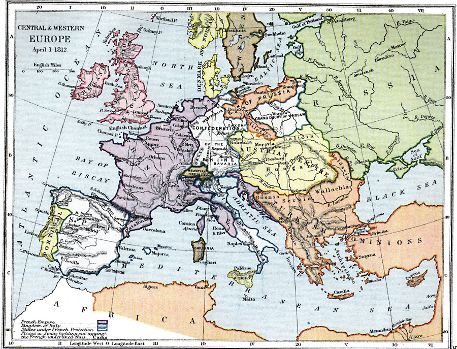
Description: A map of Central and Western Europe on April 1, 1812 at the time of the secret coalition of Britain, Sweden, and Russia against Napoleon, and prior to Napoleon's invasion of Russia (June 24, 1812). The map shows the political boundaries and principal cities at the time, the extent of the French Empire, the Kingdom of Italy, the states under French protection, and shows the places in Spain holding out against the French (underlined).
Place Names: Western and Central Europe, Ireland, �England, �Scotland, �Wales, �France, �French Empire, �Spain, �Portugal, �Russia, �Sweden, �Denmark, �Norway, �Austrian Empir
ISO Topic Categories: inlandWaters,
location,
boundaries,
oceans
Keywords: Central and Western Europe, physical, �political, �central and western europe on april 1 1812, french empire, kingdom of italy, states under french protection, spain holding out against french cadiz, physical features, country borders,
major political subdivisions, inlandWaters,
location,
boundaries,
oceans, Unknown, April 1, 1812
Source: Samuel Rawson Gardiner D.C.L., L.L.D., School Atlas of English History (London, England: Longmans, Green, and Co., 1914) 57
Map Credit: Courtesy the private collection of Roy Winkelman |
|