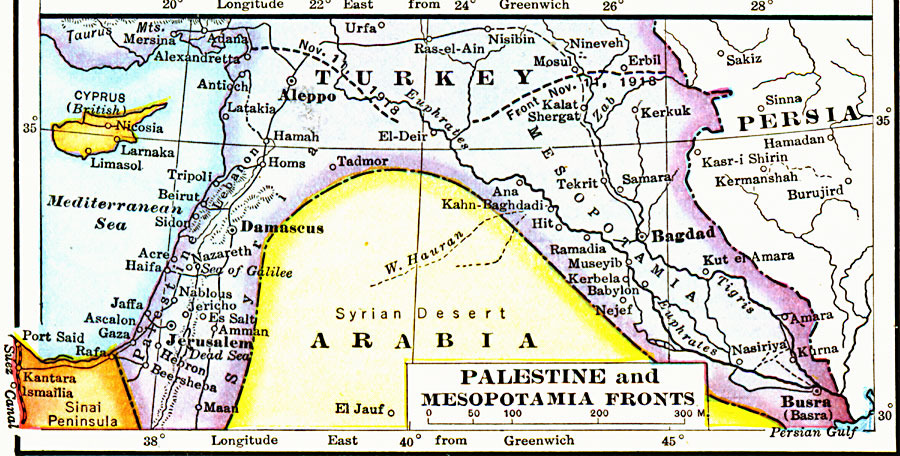
Description: A map from 1919 of the battle front between Turkey and Palestine–Mesopotamia on November 11, 1918. The map shows countries and capitals, possessions, principal cities and ports, railroads, rivers, and coastal features.
Place Names: Southwest Asia, Arabia, �Persia, �Turke
ISO Topic Categories: boundaries,
inlandWaters,
location,
oceans
Keywords: Palestine and Mesopotamia Fronts, physical, �political, �borders, �boundaries, �historical, �World War I, �WWI, �fronts, physical features, country borders, WWI, boundaries,
inlandWaters,
location,
oceans, Unknown, 1914–1919
Source: Merton M. Wilner, A New Atlas of the New World Corrected According to the Peace Terms Together with a Graphic Story of the Great War 1914-1919 (New York, NY: The Christian Herald, 1919) 15
Map Credit: Courtesy the private collection of Roy Winkelman |
|