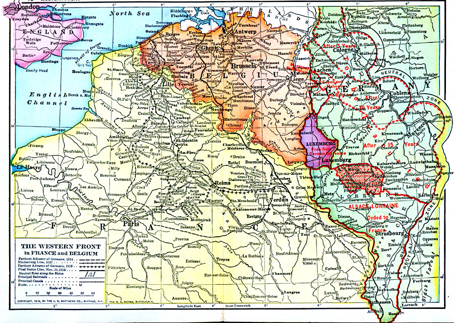
Description: A map of portions of France, Germany, Belgium, and Luxemburg between 1914 and 1918, showing the Western Front of World War I. The map shows the furthest advance of the Germans in 1914, the Hindenburg Line of 1917, the furthest advance of the Germans in 1918, the final battle line on November 11, 1918, and the Neutral Zones along the Rhine established after the Armistice. The map shows principal cities, forts, railroads, canals, terrain, and rivers of the region.
Place Names: Western Europe, Belgium, �France, �German
ISO Topic Categories: boundaries,
inlandWaters,
location,
oceans
Keywords: The Western Front in France and Belgium, physical, �political, �borders, �boundaries, �historical, �World War I, �WWI, �fronts, physical features, country borders, WWI, boundaries,
inlandWaters,
location,
oceans, Unknown, 1914–1919
Source: Merton M. Wilner, A New Atlas of the New World Corrected According to the Peace Terms Together with a Graphic Story of the Great War 1914-1919 (New York, NY: The Christian Herald, 1919) 16-17
Map Credit: Courtesy the private collection of Roy Winkelman |
|