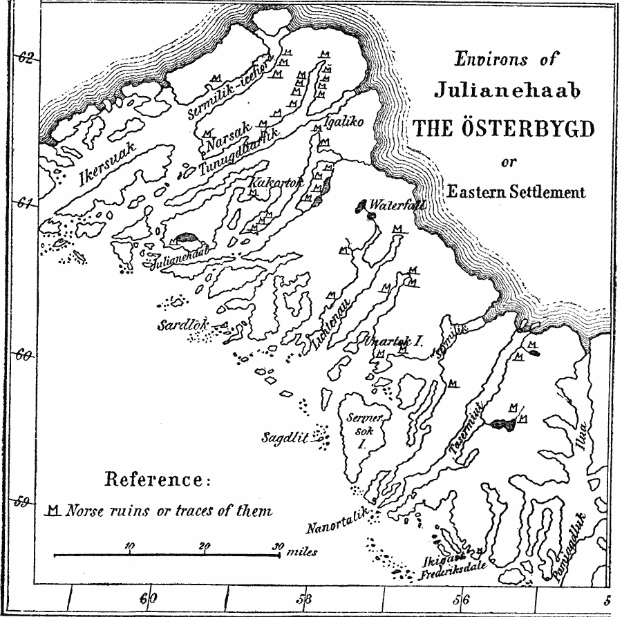
Description: A map of the southwestern tip of Greenland showing the eastern settlements of the Norse in the vicinity of Julianehaab (Qaqortoq). The map shows Norse ruins, coastline and fjords, and the interior ice fields (shaded). The sea is to the southwest.
Place Names: A Regional Map of North America,
ISO Topic Categories: oceans,
inlandWaters,
location
Keywords: Eastern Settlement of the Norse in Greenland, physical, �political, physical features, local jurisdictions, oceans,
inlandWaters,
location, Unknown, AD 1000
Source: Justin Winsor, Narrative and Critical History of America Vol 1 (New York, NY: Houghton, Mifflin, and Company, 1889) 89
Map Credit: Courtesy the private collection of Roy Winkelman |
|