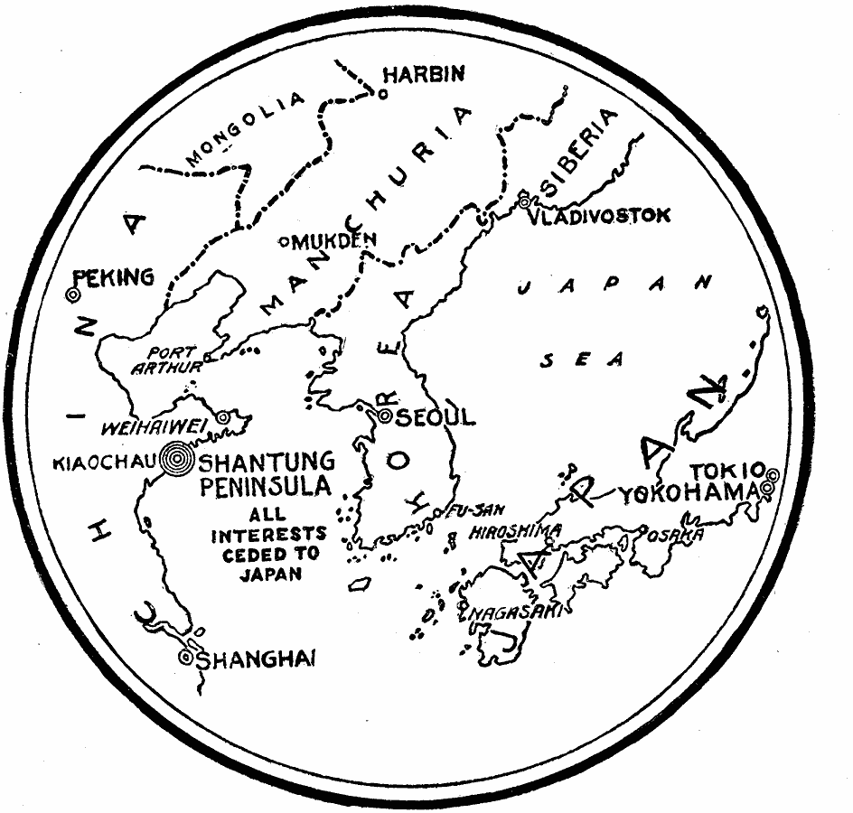
Description: A map of the Chinese Shantung (Shandong) Peninsula at the end of World War I, showing its proximity to Korea and Japan, and its strategic location between the Yellow Sea, the Gulf of Pechili (Bohai Gulf), and Port Arthur. Prior to the war, Germany had held the territory of Kiaochau on the southern portion of the peninsula. The Japanese, who had joined the Allies in declaring war on Germany, seized control of the German possessions. The transfer of the Shantung peninsula to Japan was opposed by the Chinese statesman who claimed that Germany, who ceded the territory after its defeat at the end of the first World War, possessed no rights to the land.
Place Names: Eastern Asia, China, �Japan, �Russi
ISO Topic Categories: boundaries,
location,
oceans,
intelligenceMilitary
Keywords: The Shantung Peninsula, political, country borders, boundaries,
location,
oceans,
intelligenceMilitary, Unknown, 1919
Source: Willis J. Abbot, The United States in the Great War (New York, NY: Leslie-Judge Co., 1920) 311
Map Credit: Courtesy the private collection of Roy Winkelman |
|