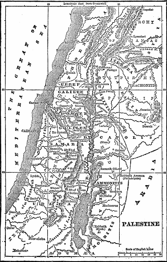
Description: A map from 1892 of Palestine, also known as the Holy Land. The map shows the divisions of the region south of Phoenicia, including Galilee, Decapolis (Iturea, Gaulanitis), Samaria, Peræa, and Judea. Biblically significant (New Testament) cities, rivers, mountains, and other sites in the region are shown.I299
Place Names: Palestine, Kedesh, �Kanah, �Jerusale
ISO Topic Categories: boundaries,
oceans,
location,
inlandWaters
Keywords: Palestine, physical, �political, physical features, major political subdivisions,
country borders, boundaries,
oceans,
location,
inlandWaters, Unknown, 1892
Source: Frank Gilbert, The World: Historical and Actual (Chicago, IL: National Library Association, 1892) 172
Map Credit: Courtesy the private collection of Roy Winkelman |
|