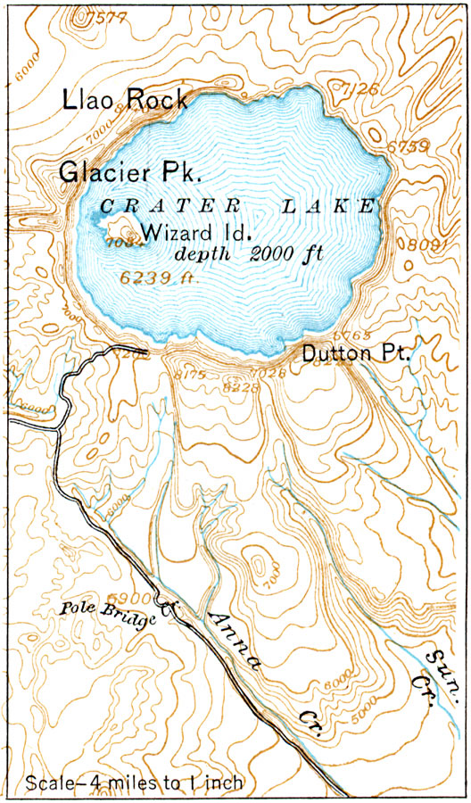
Description: A contour map from 1916 of Crater Lake in Oregon, showing elevations in feet above sea level. Crater Lake lies within the caldera of an extinct volcano (Mount Mazama), and the map indicates its depth at 2000 feet, surface elevation at 6239 feet, and the elevation of the summit of Wizard Island at 7084 feet. The map shows typical stream flow patterns of volcanic topography away from the caldera rim.
Place Names: Oregon,
ISO Topic Categories: transportation,
inlandWaters,
location
Keywords: Crater Lake, Oregon, physical, physical features, roads, transportation,
inlandWaters,
location, Unknown, 1916
Source: Albert Perry Brigham & Charles T. McFarlane, Essentials of Geography (New York, NY: American Book Company, 1916) 30
Map Credit: Courtesy the private collection of Roy Winkelman |
|